Hurricane Harvey: Prepare for Life-Threatening Event
08/25/2017 / By Thomas Dishaw
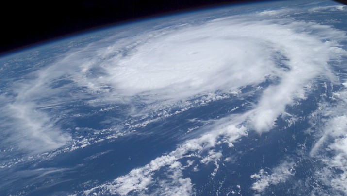
Hurricane Harvey is rapidly intensifying over the bathtub-warm waters of the Gulf of Mexico, rocketing from a tropical depression to an 85-mile-per-hour hurricane in less than 24 hours, with more intensification to come.
The storm presents south and southeastern Texas with nothing short of a worst-case scenario.
Hurricane Harvey is forecast to roar ashore along the middle Texas coast with maximum sustained winds of 125 miles per hour, making it a high end Category 3 storm, on Friday night or Saturday morning. It’s even possible it could hit as a low-end Category 4 storm, capable of causing widespread destruction.
If it hits land at such a high intensity, Harvey would be the strongest hurricane to hit the U.S. in 12 years, since Hurricane Wilma struck Florida in 2005.
The storm is straight out of central casting. It’s as if a meteorologist were asked to simulate a storm that would challenge citizens and emergency managers to the maximum degree, and then that storm were accidentally unleashed into the real world.
The rapidly intensifying storm is lumbering toward the coast, and once it makes landfall Friday night or Saturday morning, it’s forecast to sit in place for days, resulting in potentially catastrophic rainfall amounts across a broad area. Some spots could see upwards of 35 inches of rain between Friday and Wednesday, with areas including Corpus Christi and Houston in the path of heavy rainfall.
In addition, the storm will bring storm surge flooding to the coast, with as much as 12 feet of inundation above ground level expected in some spots — possibly more if the storm intensifies further.
Because the storm is likely to get trapped over South Texas for days, caught between two high pressure systems — one to the east, and the other to the west — it’s also likely that inland flooding will be compounded by the strong onshore winds, which will discourage the floodwaters from draining into the sea.
Some computer models even loop the storm back out over the Gulf of Mexico, only to make a second landfall in northeastern Texas or western Louisiana early next week.
Even the most sober-minded meteorologists have been reaching for superlatives on Thursday to try to warn Texans that what they are facing is no ordinary tropical weather system.
“Any time you have a Category 3 storm, it is a threat. Now add in the fact that it may sit in some form for almost a week dumping rain, you have a huge problem,” said Marshall Shepherd, a professor of meteorology at the University of Georgia, in an email.
Submit a correction >>
Tagged Under:
hurricane, Hurricane Harvey, Texas Hurricane Harvey
This article may contain statements that reflect the opinion of the author
RECENT NEWS & ARTICLES
COPYRIGHT © 2017 GOVTSLAVES.COM
All content posted on this site is protected under Free Speech. GovtSlaves.com is not responsible for content written by contributing authors. The information on this site is provided for educational and entertainment purposes only. It is not intended as a substitute for professional advice of any kind. GovtSlaves.com assumes no responsibility for the use or misuse of this material. All trademarks, registered trademarks and service marks mentioned on this site are the property of their respective owners.


